Note: This is a post I drafted and had mostly finished a few months ago, but which I allowed to languish. I’ve got another similar one on deck, but the content of my posts going forward is going to be kind of different.
I love to spend time in nature, and hiking is one of my favorite ways to get outside. There’s something so rewarding about power walking up a mountain and relishing the strength and capability of my body. The beautiful views also don’t hurt. So, naturally, I was excited to explore the hiking opportunities of Guatemala.
The Sierra Madre mountain range traverses the southern part of Guatemala from east to west. This range gives Guatemala most of its volcanoes, as well as its characteristic winding mountain roads. The terrain is lush and steep. Before arriving, I had seen some photos and read blog posts about some of the more famous hikes in the area, and I was determined to check some off my list.
I spent my first month in Guatemala in a small city called Antigua, the former capital of colonial Central America. During that time, I was lucky enough to go on a few great hikes from the Antigua area.
Cerro de la Cruz
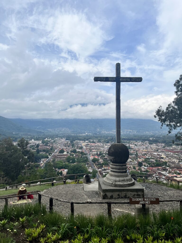
Cerro de la Cruz means “hill of the cross” in Spanish. This short hike at the north edge of the city of Antigua is named for the large stone cross on the open hillside overlooking the city. Antigua is very small, and this is one of the easiest ways to enjoy some time in nature right outside the central grid of 7×7 blocks.
On my first morning in Antigua, I set out on foot at 8:00 AM, following 1st Avenue all the way to the northeast corner of Antigua. I walked past a residential area, followed by 5 friendly stray dogs, and saw a basketball court situated right next to some 16th century ruins on the other side of the street. I arrived at the trailhead marked with a large sign. The path was all paved steps, and climbing them took me through the shade of a lushly forested hillside. Many of the tree trunks sported large, healthy air plants which would be very expensive in the plant shops of dry Colorado.
After climbing for 10 minutes, I arrived at the cross. It’s about 15 feet tall and sits in the middle of a large cobbled platform. The platform is surrounded by a landscaped clearing. From the platform, I could look out over all of the red and brown shingled rooftops of Antigua. Beyond the south side of the city sits Volcán de Agua. On a clear day, it cuts a very striking figure, but on that particular morning, its steep forested slopes were shrouded by clouds.
I climbed Cerro de la Cruz just once more during my time in Antigua, but I think if I lived there I would go a few times a week.
Pacaya
My second hike was Volcán Pacaya, one of the three active volcanoes in the area near Antigua. It was recommended to me by a chiropractor who I visited in Jocotenango, a town north of Antigua. Like many hikes in the area, it’s easiest to do with a tour group. I booked through Tropicana Hostel in Antigua, and it was $20 USD for the transport, guide, and park admission.
I opted for the 6:00 AM departure, and the Tropicana shuttle picked me up from my homestay. As we stopped for the next pickup, I noticed that one of the guys in my group was wearing the exact same shoes as me, and pointed it out (in Spanish, which I realized was silly because we were all clearly tourists). The drive to Pacaya was about an hour, heading southeast from Antigua along winding roads through forest, farmland, and small towns. We all chatted amiably during the drive. There were four of us from the US, and one from Israel. When we arrived at the trailhead, our guide Ruby introduced herself. She spoke a bit of English, but I practiced my Spanish with her. She told me she lives nearby and sometimes guides tour groups up the volcano twice a day.
As we got started, we were socked in by some low clouds. The trail is made of fine volcanic gravel, cutting a wide swath through the heavy vegetation. It was a little steep in some places, but overall not very difficult. We climbed pretty slowly because one member of our group was struggling with some residual motion sickness, and probably some altitude sickness as well. I felt ok, fortunately. I was pleased to note that even after 6 months away from Colorado, my red blood cell count was apparently still high enough to work out at altitude without any issues.
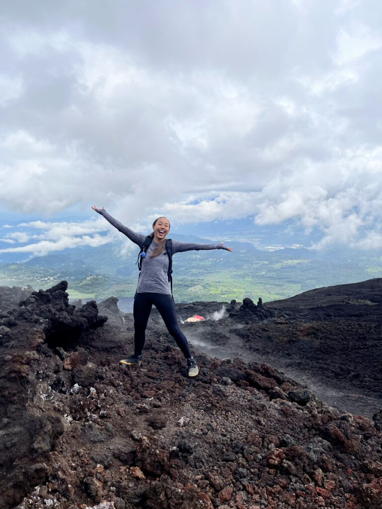
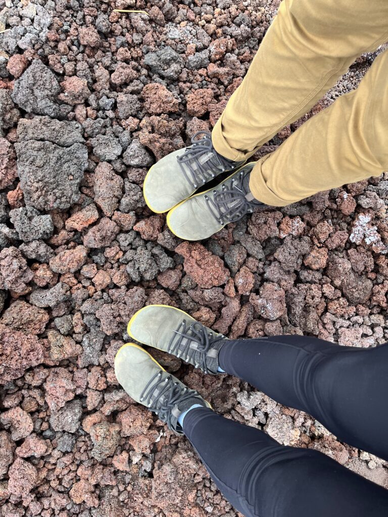
After hiking for less than an hour, we came to a place where the trail leveled off, and came out of the trees onto a big lava field. Ruby told us that the most recent flow, which was easy to identify on the slope by its darker hue, was from 2021. The lava on the slopes of Pacaya is what we would call ‘a’a in Hawaii. This type of lava is characterized by rapid expulsion from the earth, which produces jagged rocks with a lot of gas bubbles.
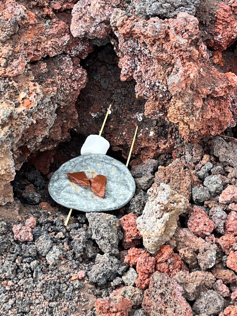
We hiked across the lava field, heading toward the steaming vents about 50 yards away. By this time, the clouds were clearing, and we had some great views of the patchwork of forest and farmland in the valley below. There was no molten lava, but we could feel the heat coming out of the ground as we walked. Ruby pulled a bag of marshmallows and skewers from her backpack, and we set our marshmallows above the hot vents. They didn’t get toasted, per se, but they were warm and gooey. A couple in my group had brought chocolate and black corn tortillas, and they made some s’more tacos.
When we got back to town, our group exchanged numbers, and some of us got together for lunch later. Over the next few days, I spent more time with the s’more taco couple. We really hit it off, and are still in touch. I know this post is about hiking, but I’ve realized that these kinds of encounters are one of my favorite things about traveling. I’ve met so many people in the months since I began traveling, but a small handful of these meetings have been really special. I’ve found a few sets of friends in different places (mostly couples, but also a few solo folks, and one pair of friends) with whom I’ve felt so at ease, engaged, and open. People whom I ended up spending a few days with because I just enjoyed them so much. And whom I’d love to see again, wherever in the world it happens to be.
Acatenango
Volcán Acatenango is arguably the most famous hike in Guatemala. It’s a 13,000-foot active volcano, but it hasn’t erupted since 1972. Its conjoined twin, Volcán de Fuego, is more dramatic, spouting lava and clouds of smoke from its conical peak a few times an hour.
While I was planning my trip to Guatemala, Acatenango was one of the places I learned about first. The hike is about 15 miles round trip, with 5,000 feet of elevation gain. Most people do it in an overnight trip, so they can climb to basecamp on their first day, and then summit at dawn the next day. In both my initial hostel and in my homestay, Acatenango was a common topic of conversation. Have you done it already? Which company did you use? Could you see Fuego?
Because I had a good experience with Tropicana Hostel for Pacaya, and another woman from my Antigua homestay had used Tropicana for her Acatenango hike, I booked with them. Another of my homestay housemates signed up with me. Because we were in the midst of our Spanish school program, our only option was to go up on a Saturday, so we would return on Sunday and not miss any class. Tropicana charged $64 USD, which included transportation (about an hour in a shuttle from Antigua), 4 meals, and local guides. We also were able to rent some gear and warm clothing from the hostel at a pretty reasonable rate.
On hike day we arrived at Tropicana with 4 liters of water apiece (3 for drinking, 1 for our guides to cook our food). We had a nice breakfast on the hostel rooftop, selected our coats, gloves, sweatpants, and rain ponchos, and loaded up our backpacks.
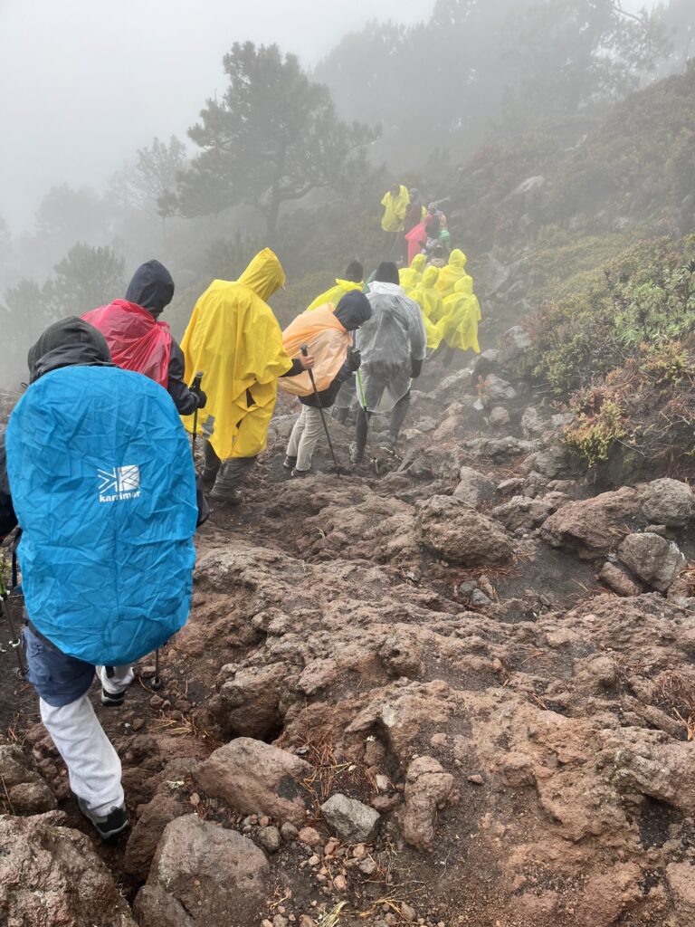
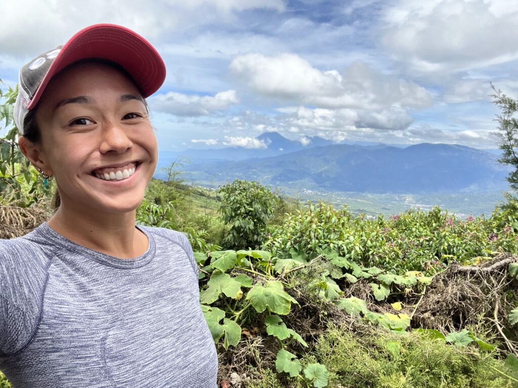
There were 28 people in our group, and we packed into 3 shuttle vans to ride up to the trailhead. On the way, I chatted with another American and his Colombian girlfriend. When we arrived, most of us rented walking sticks–there were trekking poles, but I opted for a simple, solid stick of polished wood for half the price. Our lead guide gave a brief overview and safety briefing, and a Mexican-American guy from our group translated. I took a few photos as we prepared to set out. Little did I know, that was going to be the best view we’d get on the hike.
As we started uphill, I immediately regretted everything I’d packed in my bag. I don’t have any wilderness backpacking experience (despite 8 years living in Colorado), and my 40-liter pack full of water, clothing, and the lunch I’d been given at the hostel was uncomfortably heavy as we began our ascent. Fortunately, our pace was pretty slow. Our group stopped every 20-30 minutes for a 5-10 minute break. For the group of young Irish guys who led the pack, that was too much rest, and they were overheard complaining that the rest of us were slowing them down. But there was a wide range of fitness levels. The other American who I’d been talking with in the shuttle was put on a horse pretty much immediately. I was satisfied to be in the middle of the group.
We climbed for about 5 hours, stopping for lunch halfway. We were under thick clouds the whole time, but fortunately not much rain. Besides a brief downpour as we left the lunch spot, and some mist near basecamp, we stayed pretty dry. But I was thankful for the thick yellow plastic poncho I’d purchased from the hostel. It had snaps down the sides and could comfortably cover both me and my backpack.
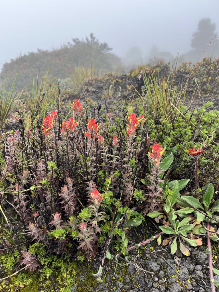
As we got closer to basecamp, we came out of the forest into a more open area. There the trail flattened out a bit, for which we were grateful. We also started to hear rumbling booms, which I first mistook for thunder. I soon realized that it was actually the sound of nearby Fuego’s explosive eruptions. The mood was light as we paused to look at the many species of flowers growing alongside the trail.
When we arrived at Tropicana’s basecamp, we were still completely socked in by clouds. There were three semi-permanent tent structures. Two larger ones housed 12 bunks each, and a smaller one was for the guide crew. Beyond that was a fire pit surrounded by some rustic benches, and a kitchen shack. Along the edge of the fire pit area was a railing, and beyond that, miles of fog. I later saw some photos taken by people who came to the same spot on clearer days, and there is usually a fantastic view of Fuego’s fiery summit from that spot.
Many of us sat down along the benches by the fire pit, and chatted for a while. The air was colder up there. We began putting on our warmer layers, and someone started a small fire. Before long, the guides told us the bunks were ready, and everyone lined up to pile in. It turned out that there were not quite enough bunks for the people in our group. There was a regular camping tent set up a short distance away, higher up on the hill and protected by a tarp. Conferring with my homestay friend, we opted to sleep in the tent, and we were eventually joined by another new friend who we’d met at breakfast.
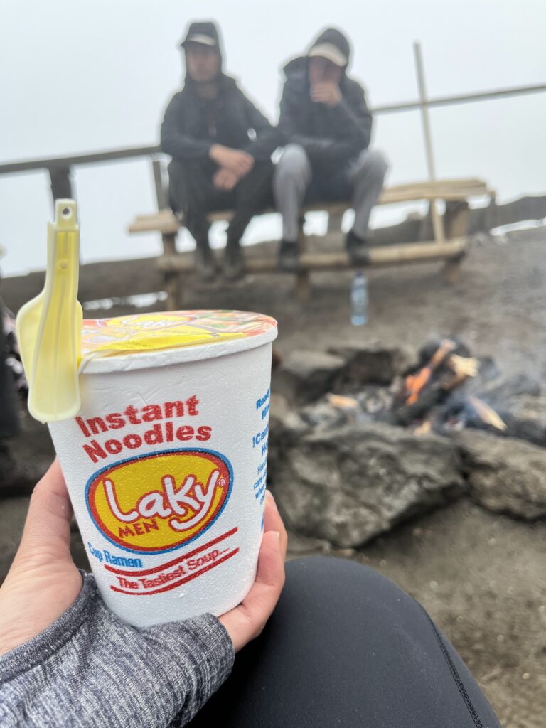
It was a 5-person tent, so ample space for 3, and the bedrolls, sleeping bags and pillows had already been set up by the Tropicana team. We went back out to the fire pit a little later to eat some hot instant ramen, which we’d each carried up in our packs. They told us dinner would be ready in about an hour, and as the temperature continued to drop, we decided to go back to the tent to wait. As we got situated and put on more warm clothes, it started to rain, lightly at first, but it got steadier and heavier. Besides going out to pee, taking turns using the heavy-duty yellow poncho I’d purchased that morning, we didn’t leave the tent again. Huge shoutout to our guide team, who came in the heavy rain all the way up to the tent to bring us hot dinner, hot chocolate, and wine that night.
The original plan was for all of us to get up at 3:30 AM to hike in the dark to see the sunrise from the summit of Acatenango. But when 3:30 rolled around and it was still cloudy and rainy, the guides told us we could go back to sleep until 6:30. At 6:30, our guides delivered oatmeal and coffee to the tent. It was still raining a little, and quite foggy. At 7:30 it was time to pack up camp and start our descent. No Fuego views for us.
The rain was light, even stopping at times as we headed back down the mountain. Though it was a little slippery in places, the hike down was much easier than the way up, unburdened as we were of our food and most of our water. It went comparatively quickly, and before long, we were back at the van pickup point. We crossed paths with some other groups who were starting their ascent there, and out of their earshot, we commented that we were glad to not be them, doing the climb in the rain. Those poor suckers were going to be miserable the whole time, and not see anything.
A few days later, in Antigua, we ran into a guy who’d been in that group, and learned that they’d had Fuego views, as had the people who went the day before us. Also, I’m pretty sure that one of the people in my hiking group gave me COVID because on Tuesday I woke up with a fever. Oh well. It was still a rewarding experience. Sometimes you have to be satisfied with doing something challenging simply for the sake of the challenge.